By Bert Reid
The Worcestershire Flora Project has been operating since 1987 with the aim of producing a comprehensive new flora of the area. Nothing comparable has been attempted since Amphlett and Ray’s 1909 flora. After 14 years, considerable progress has been made. General recording is more or less complete with all tetrads in the recording area well covered. Most of the critical groups such the roses, brambles, hawkweeds and dandelions have been given special attention and our coverage here compares well with anywhere in the country.
The remaining fieldwork is now to be concentrated on selected sites and species. There are a number of early records, which have not yet been re-found, and we wish to check if these are genuine losses within the flora. We will concentrate on records from the 1970s and early 1980s. Another outstanding task is to look at those plants that have had recent taxonomic revisions. Where taxa have been split it is desirable to revisit our earlier aggregate records to re-determine them if possible. Unfortunately, the foot and mouth restrictions seem likely to cause us to change our immediate plans.
Away from the field, the main task has been getting the records on to a computer database. The bulk of post 1987 records have been entered and we will have all records to the end of 2000 completed by this autumn. A start has been made on earlier records, mainly those between 1970 and 1986 and this date class is more than half completed. Little work has been done so far on pre-1970 data.
A few selected maps follow to give some idea of where we are up to. The darker dots are records from 1987 onwards and the paler dots represent earlier records. The data is not complete. Some records from 1998 onwards have yet to be entered to the database and the pre-1987 records are very incomplete.
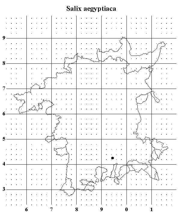
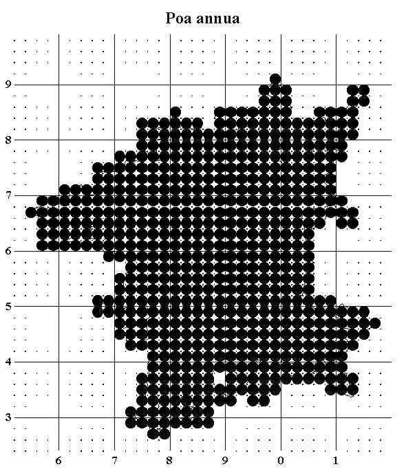
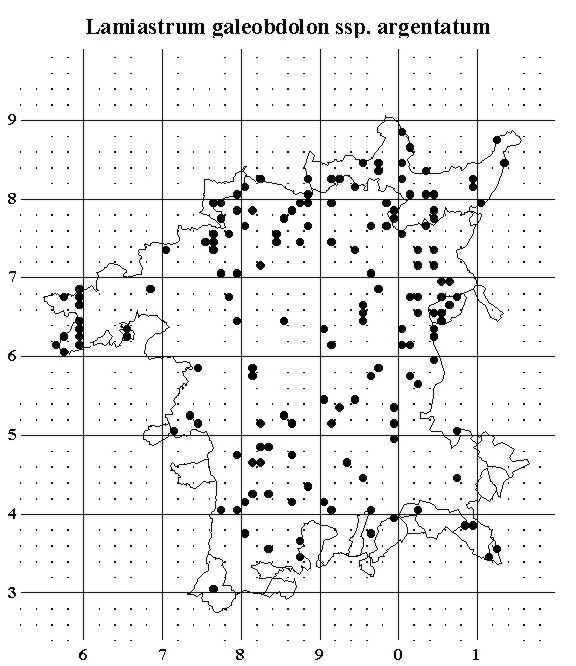
Not all maps tell a lot. The map for the alien willow Salix aegyptiaca shows the one county record, where the bush by the Berwick Brook was probably planted. The Annual Meadow-grass Poa annua map has lots of data but little information. This plant is clearly at home throughout the county. The map for the variegated garden form of Yellow Archangel Lamiastrum galeobdolon ssp argentatum looks more interesting but is hard to relate to any natural features. This increasing garden escape will compete well in many habitats (woodland, plantations, roadsides, ruderal) and the map simply shows the incidence of chance discards. I predict that in future this species will show a much greater coverage
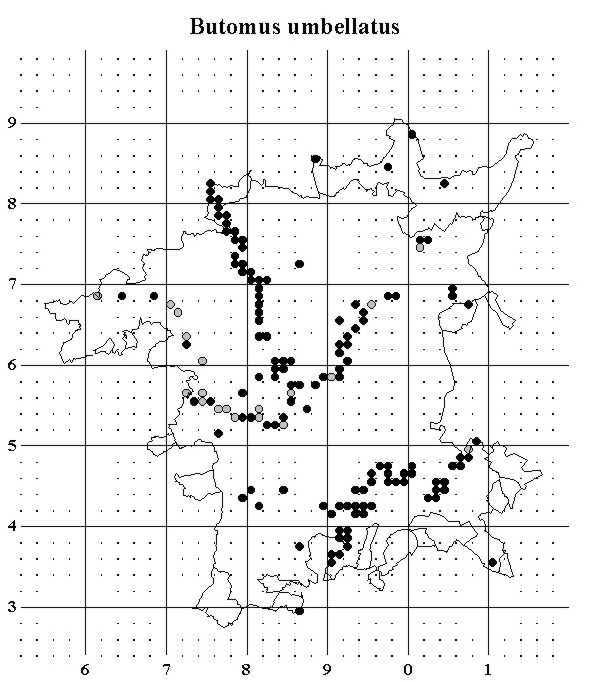
The map for Flowering Rush Butomus umbellatus shows clearly that this is a plant of linear water features. The Rivers Avon, the Severn north of Worcester, and the Teme are all picked out clearly while the records from the Worcester to Birmingham Canal show that still waters are utilised as well as flowing. The concentration of pre-1987 records along the Teme suggests that the plant may have declined in this area. The steep banks with little edge vegetation probably cause the shortage of records from the Severn below Worcester.
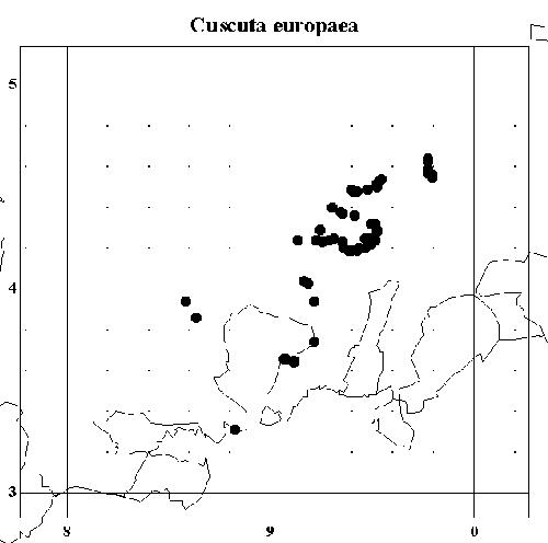
The nationally scarce Greater Dodder Cuscuta europaea is another plant of riverbanks, but has a more restricted distribution within Worcestershire. Apart from a very few records on the Lower Severn, the plant is concentrated on the River Avon. The map picks out the curve of the river around Birlingham very clearly. The plant is parasitic on nettles and rarely grows more than a few metres from the water edge. The number of plants varies considerably from year to year, probably related to riverbank clearance. There were no records for Greater Dodder on the Avon before the flora project.
Danish Scurvygrass Cochleria danica is a recent addition to Worcestershire’s flora. This coastal plant has spread along the salted verges of major roads throughout Britain. The map picks out the M50, M5, A449 etc. This map is rather incomplete. Many records are awaiting entry: the missing chunks of the M5 in particular will be filled up once the database is up to date. When complete, the map will be a usable major road map of Worcestershire.
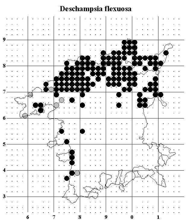
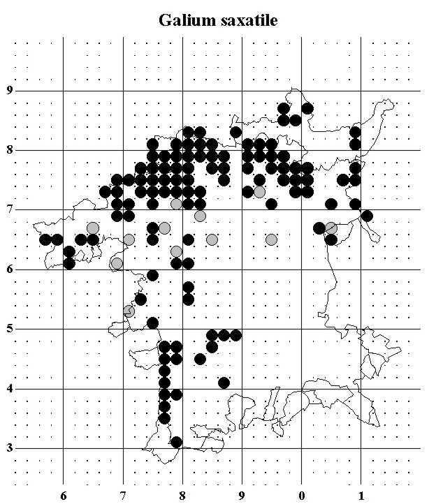
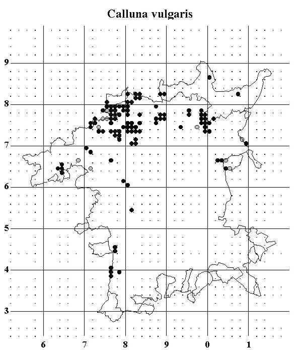
The next three maps are all of plants with a strong preference for acid soils. On these soils, Wavy Hair-grass Deschampsia flexuosa and Heath Bedstraw Galium saxatile are quite common and widespread. They are found across the north of the county, being equally at home on the Lickey Hills, the sandy heaths around Kidderminster, and the more open areas of the Wyre Forest. The also reach the far west of the county on the more acidic areas of the Malverns. Heather Calluna vulgaris has much the same distribution but is generally scarcer. It is unable to withstand heavy grazing and competes poorly on the better soils.
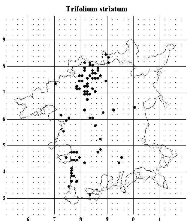
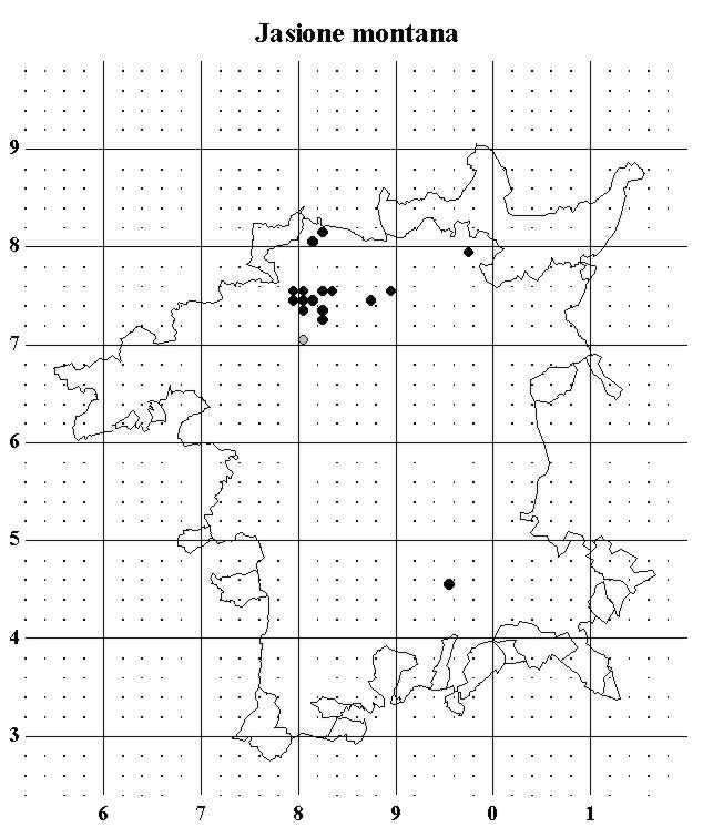
The next three calcifuge species are more demanding. Bilberry Vaccinium myrtillus will not grow on the dry sands but is reasonably shade tolerant. It has its stronghold in the Wyre Forest with smaller populations on the Lickey Hills and Malverns. It is absent from the sandy heaths around Kidderminster. Knotted Clover Trifolium striatum and Sheep’s-bit Jasione montana have the opposite preference, needing well drained open soils. For these plants, the Kidderminster area is the main centre.
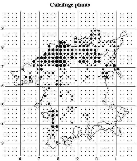
These are followed by a map shows the coincidence of the six calcifuge plants shown above. The dot size is determined by how -many of the six taxa have been found in each tetrad with larger dots signifying more species. The absence from the centre and southeast is very striking even the few records around Pershore are only non-persistent records introduced with building sand etc. Otherwise the map is a pretty accurate representation of the acid soils of the county.
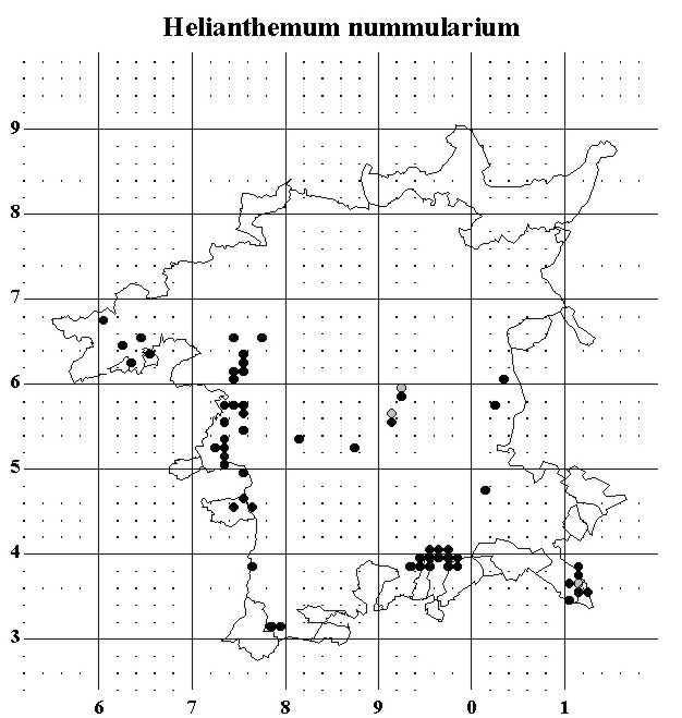
The map for Common Rock-rose Helianthemum nummularium is very different. This plant is virtually restricted to well-drained calcareous soils, and the map shows the limestone areas very clearly. The records are concentrated on the Cotswold edge above Broadway, Bredon Hill, and the western areas around the Suckley Hills. Other records pick out similar soils such as the Rhaetic limestone of Bishampton Bank and limestone bands in the Lower Lias around Trench Wood.
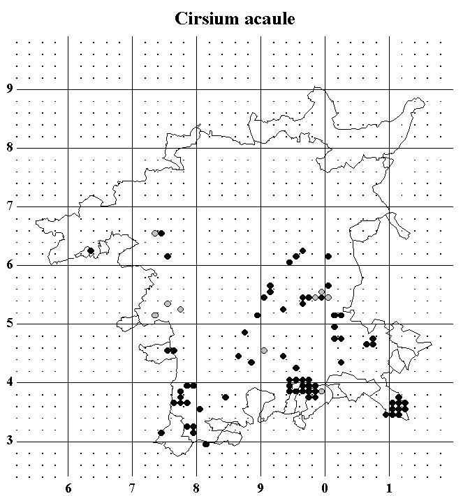
The Dwarf Thistle Cirsium acaule has similar requirements to the Rock-rose with the same concentrations on the Broadway Cotswolds and Bredon Hill but with many fewer records on the western hills. It is also found in some Lias clay meadows, especially on the ridges of old ridge and furrow meadows.
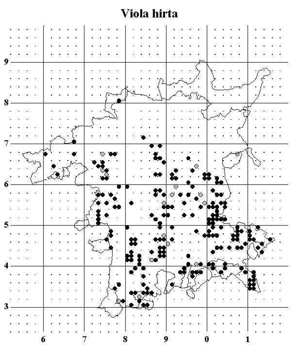
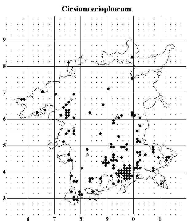
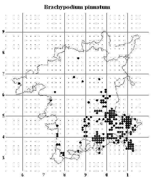
The Hairy Violet Viola hirta is less concerned about good drainage and can be found on the more calcareous marls, giving it a wider distribution in the county. Woolly Thistle Cirsium eriophorum cannot tolerate very heavy grazing, but can compete well in the taller vegetation of rough grassland. Tor Grass Brachypodium pinnatum has a marked southeastern distribution: outside this stronghold it tends to be restricted to habitats such as churchyards and railway banks. Each of these calcicoles have slightly different preferences which are mirrored in their distributions.
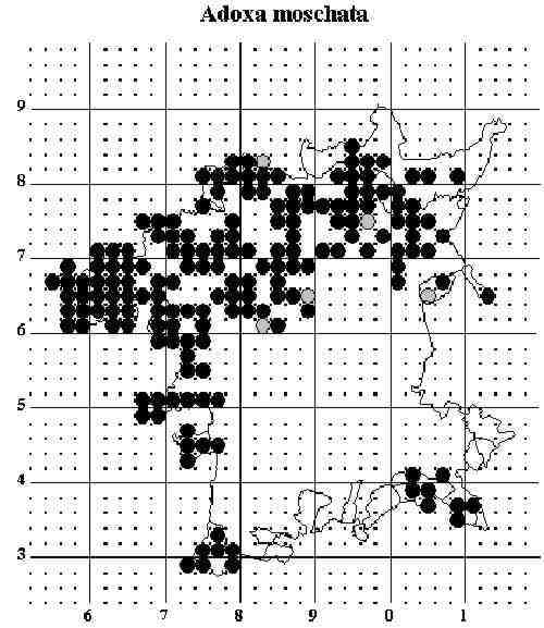
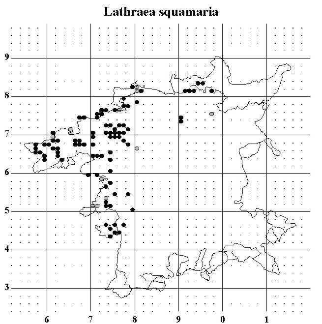
Moschatel Adoxa moschata is widespread in the north of the county, though only very locally common. It is also found in woodlands around Broadway in the southeast, and in the southwestern tip of the county, but is entirely absent from the marls and clays of the centre. Toothwort Lathraea squamaria is much more restricted with not one record from the whole southeast half of the county. This plant is parasitic on Hazel, which is common throughout our area. It is not obvious why the plant is so restricted, especially since it is not uncommon in its core area.
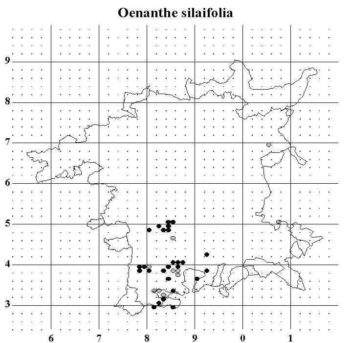
Narrow-leaved Water-dropwort Oenanthe silaifolia has a very specific habitat requirement. It is found on unimproved meadows within the Severn and Avon flood plains and can be abundant in the best spots. This is a nationally scarce species, and our populations are of national importance.
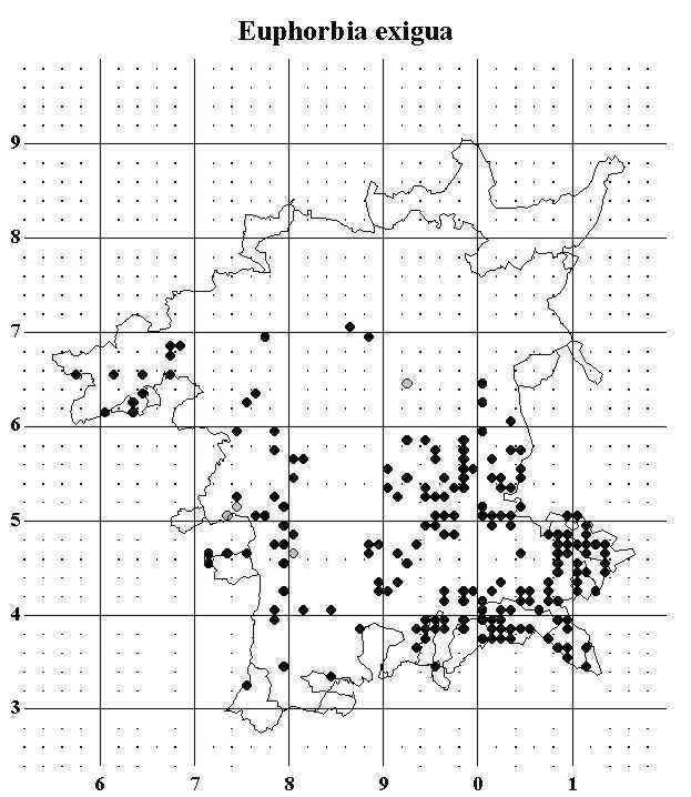
Dwarf Spurge Euphorbia exigua is an arable weed. Like many once common weeds it has suffered a severe decline throughout Britain as a result of agricultural intensification. As the map shows, it is still quite widespread in Worcestershire, especially in the southeast, though it is usually only present in small numbers. The records for this and for other scarce weeds suggest that Worcestershire has suffered a little less than most parts of the country from excessive agricultural herbicide use.
Canadian Fleabane Conyza canadensis is an alien found mainly in ruderal habitats, though it occasionally appears in arable. The map shows the main cities and towns with almost compete coverage, but with many fewer records from the most rural areas.
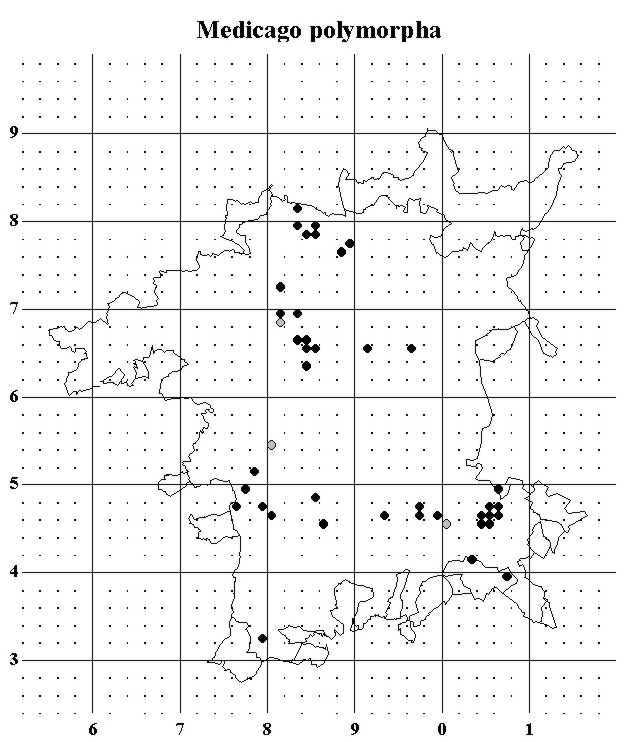
The distribution of Toothed Medick Medicago polymorpha is difficult to interpret. At first glance it might be thought that it is a scarce native of river terrace soils but it is almost certainly not native in the county. The true explanation for its distribution requires a knowledge of past cultivation practices. It probably arrived with wool shoddy, which was once used to improve low fertility soils. The map mainly shows where wool shoddy was used in the county.
The final map is of Narrow-leaved Bird’s-foot-trefoil Lotus glaber. This has an unusual distribution in the county centred on the area in SO95 around Grafton Flyford. This is typical ancient countryside on Lias clays, with many small hedged fields, winding lanes and small woods. The plant typically grows on green lanes or species rich verges. The Lias areas to the south in SO94 are quite different in character, having a long history of cultivation, and the Lotus is absent from here.
These few maps are intended to give a brief indication of the use to which the data collected over 14 years can be put. Worcestershire is a county of great contrasts, with complex geology, land use, climate and history. When the flora is written, the interpretation of distribution patterns will be much more comprehensive and rigorous than my brief un-researched comments here, but I hope this taster will whet a few appetites for the main course.
| WBRC Home | Worcs Record Listing by Issue | Worcs Record Listing by Subject |