Worcestershire Record No. 19 November 2005 p. 6
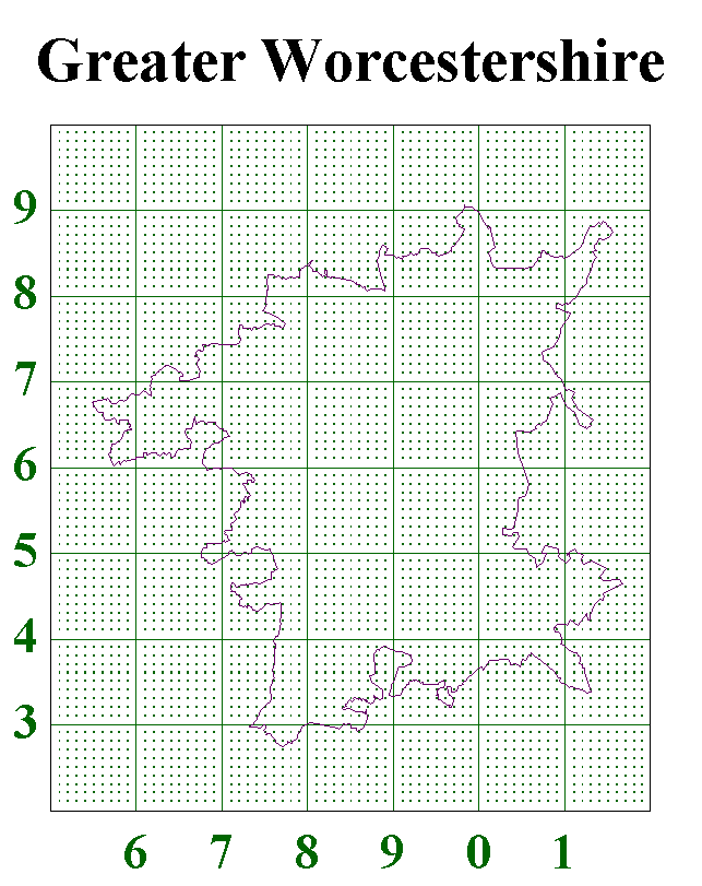
We are often asked by recorders to tell them exactly where a certain part of the County Boundary lies. Our primary boundary is the Watsonian Vice County VC37. However, the Worcestershire Flora Project adopted “Greater Worcestershire” which also incorporates the those parts of the modern administrative county outside the VC. The WBRC now uses Greater Worcestershire for the collection of records. In addition we generally hold records from SO77 because this square contains Wyre Forest, a clear ecological and recording unit which inconveniently straddles the Worcestershire/Shropshire Boundary.
The map shown below (prepared by Bert Reid) shows the Greater Worcestershire boundary and 1x1km squares (monads) of the National Grid as shown on OS maps. We hope this will give recorders a good clue to the position of the boundary. However is you want more detail arrange to visit the Worcestershire Biological Records Centre (email Simon Wood simon@wbrc.org.uk, telephone 01905 759759) to look at the 1:25000 OS maps held there and marked more exactly with the boundary. The originals for these maps were prepared by the Worcestershire Flora Project from OS one inch to the mile maps held as the Natural History Museum in London.
| WBRC Home | Worcs Record Listing by Issue | Worcs Record Listing by Subject |